
News 25 Jan 2024
Paavo provides regional data for different purposes
Which postal code areas in Finland are most dominated by blocks of flats? And where in Finland is the average income of inhabitants the highest? This and much more information can be found in Statistics Finland’s free-of-charge Paavo service, which also includes a time series. All Paavo statistical data have been published with the latest classification of postal code areas starting from 2010. The service’s data have been updated today, on Paavo's name day.
Paavo - Open data by postal code area contains diversified statistical and map data by postal code area. The data are available as an easy-to-use database and downloadable through the interface service. The data can be used for decision-making or for learning more about your area of residence.
Postal code areas with most dwellings in blocks of flats in relative terms in 2022
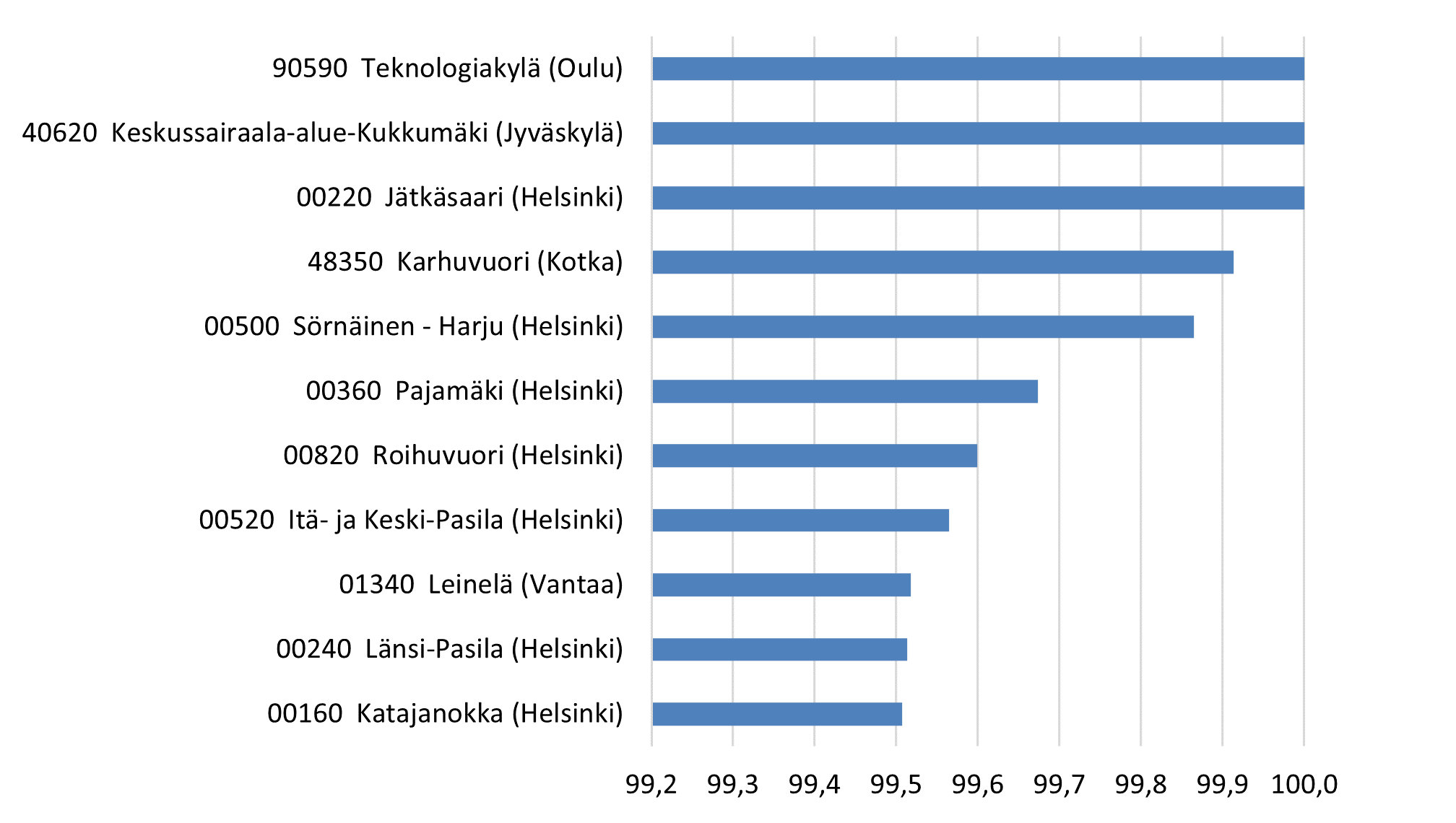
Paavo's statistical data contain data on the areas' population structure, the degree of education, the income of the inhabitants and households, the size of households and life stage, buildings and dwellings, workplaces, and the main activities of the inhabitants. New data are updated to the service annually in January.
Further information: erityispalvelut@stat.fi